Skip to header Skip to main navigation Skip to main content Skip to footer

User account menu

  • Log in
RRNMLLC

Main navigation

  • Home

Hiking Trails

Breadcrumb

  • Home
  • Hiking Trails

Wild Rivers in Fall: Rim Views, Steep Trails and a Closed La Junta
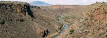
The Rio Grande winding through the deep basalt gorge at the Wild Rivers Recreation Area near Questa, New Mexico.

October may be the best month of the year at the Wild Rivers Recreation Area, north of Questa. Summer heat has left the gorge, the light is low and clear, and the trails that drop 800 feet from the rim to the Rio Grande are far more forgiving than they are in July. The recreation area, managed by the Bureau of Land Management within the Rio Grande del Norte National Monument, protects the place where the Red River joins the Rio Grande in a deep canyon cut through dark volcanic rock.
  • Read more about Wild Rivers in Fall: Rim Views, Steep Trails and a Closed La Junta

Williams Lake in Mid-October: A Short Climb to 11,040 Feet

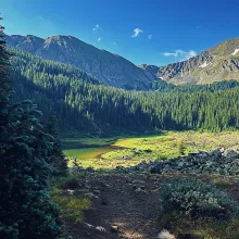
Williams Lake sits in a green alpine meadow below forested slopes and rocky peaks near Taos Ski Valley.

Not every good October hike in Carson country has to end on a summit. Williams Lake Trail No. 62, above Taos Ski Valley, offers a shorter high-country outing with a real alpine payoff: a natural lake at 11,040 feet, tucked in a basin below Wheeler Peak in the Wheeler Peak Wilderness.

  • Read more about Williams Lake in Mid-October: A Short Climb to 11,040 Feet

Middle Fork Lake in Mid-October: One Last Climb to Red River's Headwaters

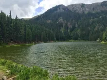
Middle Fork Lake above Red River, its forested shoreline backed by a rocky ridge in the Carson National Forest.

Some hikes earn their lake. The Middle Fork Lake Trail, Trail 487 in the Carson National Forest above Red River, is one of them — a difficult two miles one way that climbs from 9,650 feet to a quiet alpine lake sitting at 10,845 feet. Mid-October is close to the last comfortable window to make the climb before winter takes the high country back, and for hikers who like their trails steep, wooded and uncrowded, it is one of the finest short backpacks-or-day-hikes left on the fall calendar.

  • Read more about Middle Fork Lake in Mid-October: One Last Climb to Red River's Headwaters

Cabresto Lake in October: Brook Trout, High Peaks and a Quiet Latir Gateway

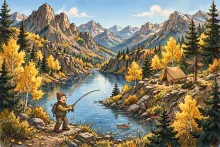
Cartoon illustration of an angler casting at a high mountain lake surrounded by peaks, pine and golden aspen trees near a small campsite.

High above Questa, Cabresto Lake offers one of the quietest corners of the Carson National Forest in October. The Forest Service lists the small campground there as open, with four semi-dispersed campsites at 9,500 feet on a level ridge overlooking the lake, surrounded by high peaks. It is a simple, high-country base for anglers and hikers who prefer fewer crowds to full facilities, and mid-October is a fine time to see it before winter weather settles into the Sangre de Cristo Mountains.

  • Read more about Cabresto Lake in October: Brook Trout, High Peaks and a Quiet Latir Gateway

South Boundary Trail in Fall: One Last Ride Through the Aspens

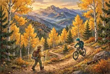
Cartoon illustration of a mountain biker and hiker on a trail through golden aspen groves in the Carson National Forest.

Mid-October is the sweet spot for the South Boundary Trail, and also the warning bell. The aspens along this high-country route between Angel Fire and Taos are at their brightest right now, and the window before snow closes the upper trail is getting short. For hikers, riders and mountain bikers who have been putting it off all summer, this is the week to go.

  • Read more about South Boundary Trail in Fall: One Last Ride Through the Aspens

Questa to Red River Trail Approved: A 12-Mile Link on the Way

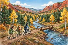
Cartoon illustration of hikers and a cyclist on a riverside trail with a wooden bridge in a pine and aspen canyon.

Two northern New Mexico mountain towns that have long been linked by a winding highway will soon be linked by trail as well. The Carson National Forest has approved the Questa to Red River Trail, an approximately 11.9-mile unpaved, multi-use pathway between the Village of Questa and the Town of Red River.

  • Read more about Questa to Red River Trail Approved: A 12-Mile Link on the Way

Wheeler Peak in October: Last Call for New Mexico's Highest Summit

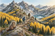
Cartoon illustration of two hikers climbing a rocky switchback trail above treeline toward Wheeler Peak, with golden aspens, an alpine lake, and a dusting of early snow.

Mid-October is the shoulder season on Wheeler Peak, and the window for a straightforward hike to the top of New Mexico is closing. Snowfall typically begins in the Wheeler Peak Wilderness in early October, and every calm, clear fall day from here on is a gift. Hikers who want the 13,161-foot summit — the highest point in the state — without snowshoes or skis should be watching the forecast and picking their day now.

  • Read more about Wheeler Peak in October: Last Call for New Mexico's Highest Summit

Wheeler Peak via Williams Lake: New Mexico's Rooftop Hike

Cartoon illustration of a rocky mountain summit with a stone cairn, alpine lake, and pine forest below.

Every state has a rooftop, and New Mexico's sits deep in the Carson National Forest. Wheeler Peak rises to 13,161 feet, the highest ground in the state, and the most popular way to stand on it is the Wheeler Peak Trail via Williams Lake — about eight miles round trip with roughly 3,000 feet of elevation gain, starting near Taos Ski Valley.

  • Read more about Wheeler Peak via Williams Lake: New Mexico's Rooftop Hike
Subscribe to Hiking Trails

Copyright © 2026 Rocky Mountain Madman LLC - All rights reserved

Developed and Designed by Rocky Mountain Madman LLC